Rhoose Point
Rhoose Point (Welsh: Trwyn y Rhws) is the most southerly settlement of mainland Wales, although there are claims that Breaksea Point south of Gileston, is the most southern point. The Vale of Glamorgan Council had installed a permanent notice verifying Rhoose Point as the most southerly part of Wales's mainland and there is a small stone circle marking the point as well. Looking in detail at other sources of information in January 2021, revealed that there is very little difference in the northings above the latitude of 51° — in fact a fraction of minutes of arc. In the light that Breaksea Point has had a heavy sea wall from 1958 (with the construction of Aberthaw "A" power station), its geographical location became fixed whereas Rhoose point is continually 'creeping' inland slightly, due to cliff face erosion.
.jpg.webp)
Both points lie on the south coast of the Vale of Glamorgan in South Wales and project into the Bristol Channel and are 4.42km apart.
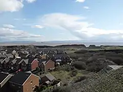
North of Rhoose point, Rhoose cement works and an asbestos works used to be located but on complete demolition and reworking of the land, Rhoose Point and the former cement works site and main quarry have become the site of Rhoose Point Housing scheme. Well over 1000 houses have greatly extended the village of Rhoose and more were being built north of the Vale of Glamorgan Railway line to the north in 2020.
To the east, the island of Flat Holm in the Bristol Channel, currently under the administration of Cardiff, South Wales, lies almost on the same latitude as Rhoose and Breaksea Points. According to Trinity House, its co-ordinates are 51°-22'N and 3°-07'W.