Gopalganj Sadar Upazila
Gopalganj Sadar (Bengali: গোপালগঞ্জ সদর) is an upazila of Gopalganj District in the Division of Dhaka, Bangladesh.[1]
Gopalganj Sadar
গোপালগঞ্জ সদর | |
|---|---|
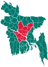
 Gopalganj Sadar Location in Bangladesh | |
| Coordinates: 23°1′N 89°50′E | |
| Country | |
| Division | Dhaka Division |
| District | Gopalganj District |
| Area | |
| • Total | 391.35 km2 (151.10 sq mi) |
| Population (1991) | |
| • Total | 291,409 |
| • Density | 745/km2 (1,930/sq mi) |
| Time zone | UTC+6 (BST) |
| Website | Official Map of Gopalganj Sadar |
| dcgopalganj.gov.bd | |
History
Gopalganj sadar is the main town of Gopalgonj District. 15 MPs are from there. It has 15 banks, including 3 commercial banks .It may take 5 hours to reach by road from Rajdhani (depending on traffic). After the Liberation War Gopalgonj Sadar become 'Pourashava'. As a close fellow of Bangabandhu Sheikh Mujibur Rahman Panna Biswas of Gimadanga was selected as first Chairman. Khan Saheb Sheikh Mosharrof Hossain, Molla Jalaluddin Ahmed, Hemaet Uddin, Wahiduzzaman, Fayekuzzaman are well known figures among the others born in Sadar upozila. Gopalgonj (town) consists of 21 wards and 72 mahallas. The area of the town is 46.88 km2. The town has a population of 85, 398; male 51.07%, female 46.93%. The density of population is 6874 per km2. The literacy rate among the town people is 75.1%.
Geography
Gopalganj Sadar is located at 23.0167°N 89.8333°E. It has 51, 630 households and a total area of 391.35 km2.
Demographics
According to the 1991 Bangladesh census, Gopalganj Sadar had a population of 291,409. Males constituted 50.73% of the population, and females 49.27%. The population aged 18 or over was 141,978. Gopalganj Sadar had an average literacy rate of 44.7% (7+ years), against the national average of 32.4%.[2]
It has 57 schools, 13 colleges, and 2 university colleges.
Places of interest
- Ulpur has a former Zamindar palace, which is currently used a Tehsil Office. Arpara has a former Zamindar Palace, too. Kotalipara is very improved, having RAMSIL P.O...
Administration
Gopalganj Sadar Upazila is divided into Gopalganj Municipality and 21 union parishads: Borasi, Baultali, Chandra Dighalia, Durgapur, Gobra, Gopinathpur, Haridaspur, Jalalabad, Kajulia, Karpara, Kati, Latifpur, Majhigati, Nizra, Paikkandi, Raghunathpur, Sahapur, Satpar, Suktail, Ulpur, and Upafi. The union parishads are subdivided into 127 mauzas and 197 villages.[3]
Gopalganj Municipality is subdivided into 9 wards and 47 mahallas.[3]
Education
There are ten colleges in the upazila: Dr. Dilawar Husain Memorial College, Government Nazrul Degree College Satpar, Government Bangabandhu College, Gopalgonj, Haji Lalmia City College, Kazi Zahural Huq College, Krishnapur Shaptodas Palli College, M. H. Khan Degree College, N. Haque College of Business & Technology, Sabira - Rouf College, and Sheikh Fazilatunnesa Government Women's College.[4]
According to Banglapedia, Boutali Sahapur Sammilani High School, founded in 1928, Chandra Dighalia High School, Gopinathpur High School (1911), S. M. Model Government High School, Swarnakali High School, and Ulpur PC High School (1900) are notable secondary schools.[1]
References
- Gain, Swapan (2012). "Gopalganj Sadar Upazila". In Islam, Sirajul; Jamal, Ahmed A. (eds.). Banglapedia: National Encyclopedia of Bangladesh (Second ed.). Asiatic Society of Bangladesh.
- "Population Census Wing, BBS". Archived from the original on 2005-03-27. Retrieved November 10, 2006.
- "District Statistics 2011: Gopalganj" (PDF). Bangladesh Bureau of Statistics. Archived from the original (PDF) on 10 October 2015. Retrieved 14 July 2014.
- "List of Colleges". Department of Secondary and Higher Education. Retrieved 6 September 2020.
